by Karissa Courtney
Background
Boulder County and the City of Boulder have done a great job of protecting the native lands around us. Of course, it can’t be perfect with the number of people that live around here, but Boulder has shown its care for protecting and restoring the lands around us. In 1898 Boulder County began acquiring lands and now owns 65,897 acres of Open Space land and 39,489 acres of protected private land (conservation easement), and starting in 1967 the City of Boulder began acquiring its own lands and now owns 45,000 acres of Open Space and Mountain Parks land in and around Boulder. This is practically unheard of in other parts of the country and I think we can feel proud of the land protection that our local community has achieved.

Related to this, are the wetlands of Boulder. These are few and far between in the dry front-range and it is Boulder’s goal to keep these special environments intact. The city’s wetland ordinance was adopted in 2009 (you can read it in full here) saying,
“It is the intent of the city council in enacting this section to preserve, protect, restore, and enhance the quality and diversity of wetlands and water bodies. The council finds that streams, wetlands, and water bodies are indispensable and fragile natural resources with significant development constraints due to high groundwater, flooding, erosion, and soil limitations and that development activities may threaten these resources.” (Chapter 3, 9-3-)
Additionally, the Boulder Valley Comprehensive Plan (you can read it here) in section 3.06 also says that the city will strive for “no net loss of wetlands and riparian areas by discouraging their destruction.” Wetlands are also highlighted in the Grasslands Ecosystem Management Plan (you can read it here), accepted in 2010, where it also states, “Aquatic systems on OSMP lands support biodiversity well out of proportion to their relatively small size. These same areas are also identified as having low viability and high level of conservation issues.”. Therefore, it has been well agreed upon that the wetlands in Boulder are very valuable for their ecological role as a wildlife habitat, and the city and county will continue to protect these “historically scarce” areas and educate the public on them.
Goose Creek
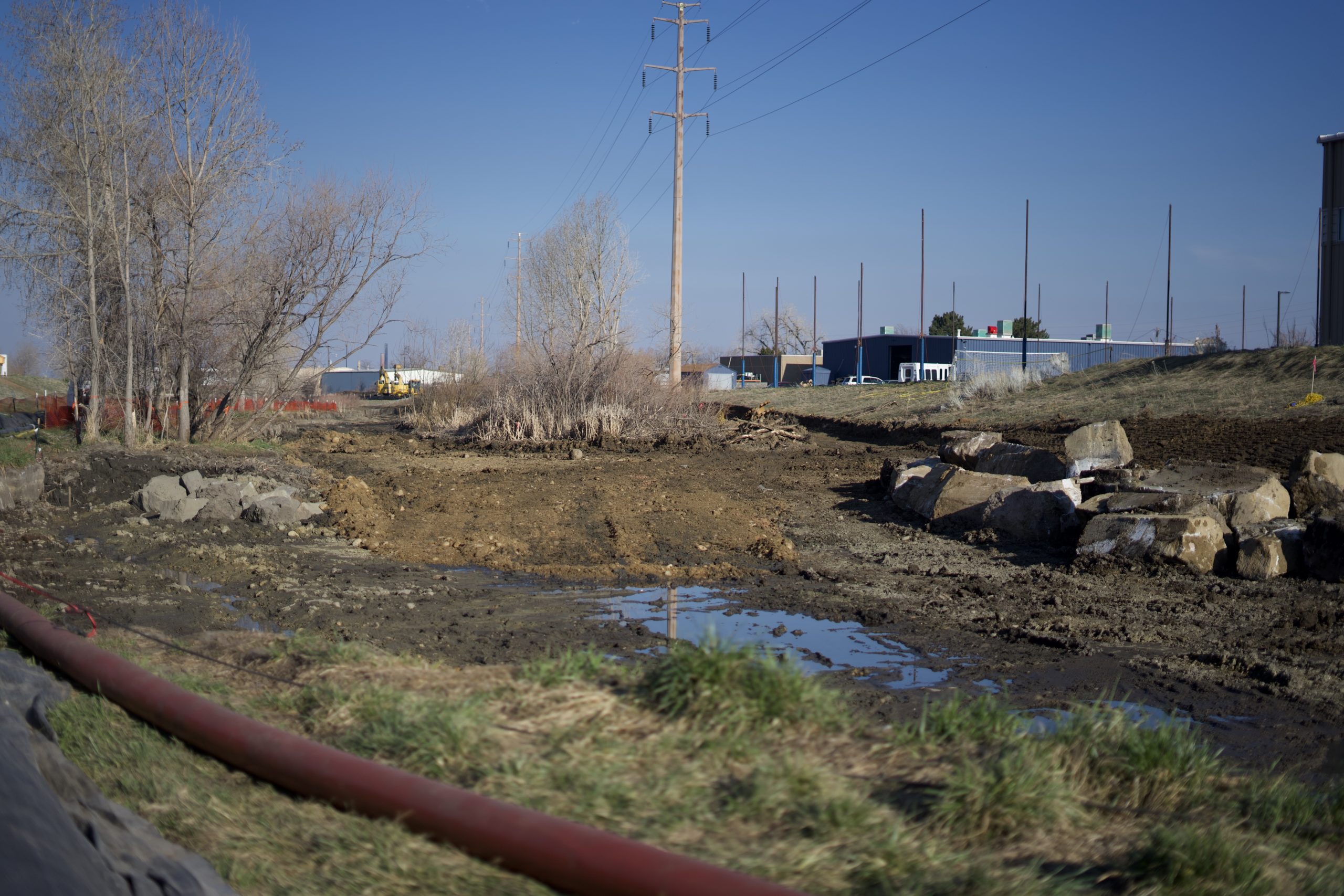
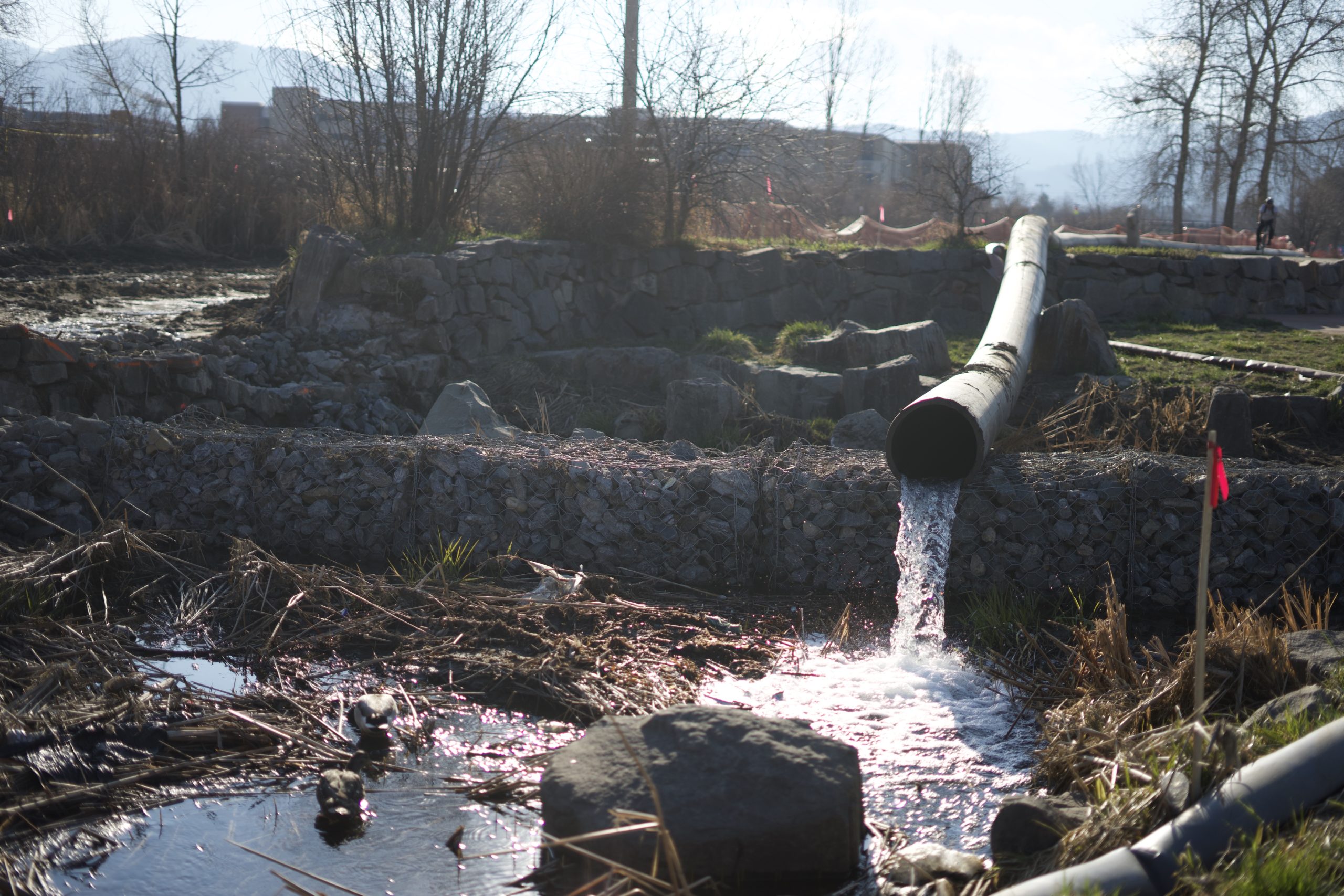
Goose Creek is part of the important wetland system of Boulder. It is a 4 mile stretch of waterway, usually invisible to the passerby. It is hidden inside culverts, runs through backyards, and along the paths. It begins near North Boulder Park and flows eastward to the south of Edgewater Street. It joins Two-Mile Creek and Elmer’s Two-Mile Creek near Folsom and Valmont. Further on it joins the Boulder Creek, which then connects to the South Platte River, making it a part of the Boulder Creek Watershed. It has been noted that Goose Creek is considered a major threat for flash flooding. These flooding events are not only bad for the people in the area, but also the riparian habitats that get washed away. The Goose Creek Channel Improvement Project is one that is helping mitigate these flood events. Goose Creek has been filled in with sediment and plant growth, resulting in a non-discernable channel. This low-flow channel issue is a problem as it results in frequent flooding of a heavily trafficked public trail and has created a public safety hazard. If you frequent the Goose Creek Path, you probably have noticed the section close to Foothills that has been getting torn up – the project site.
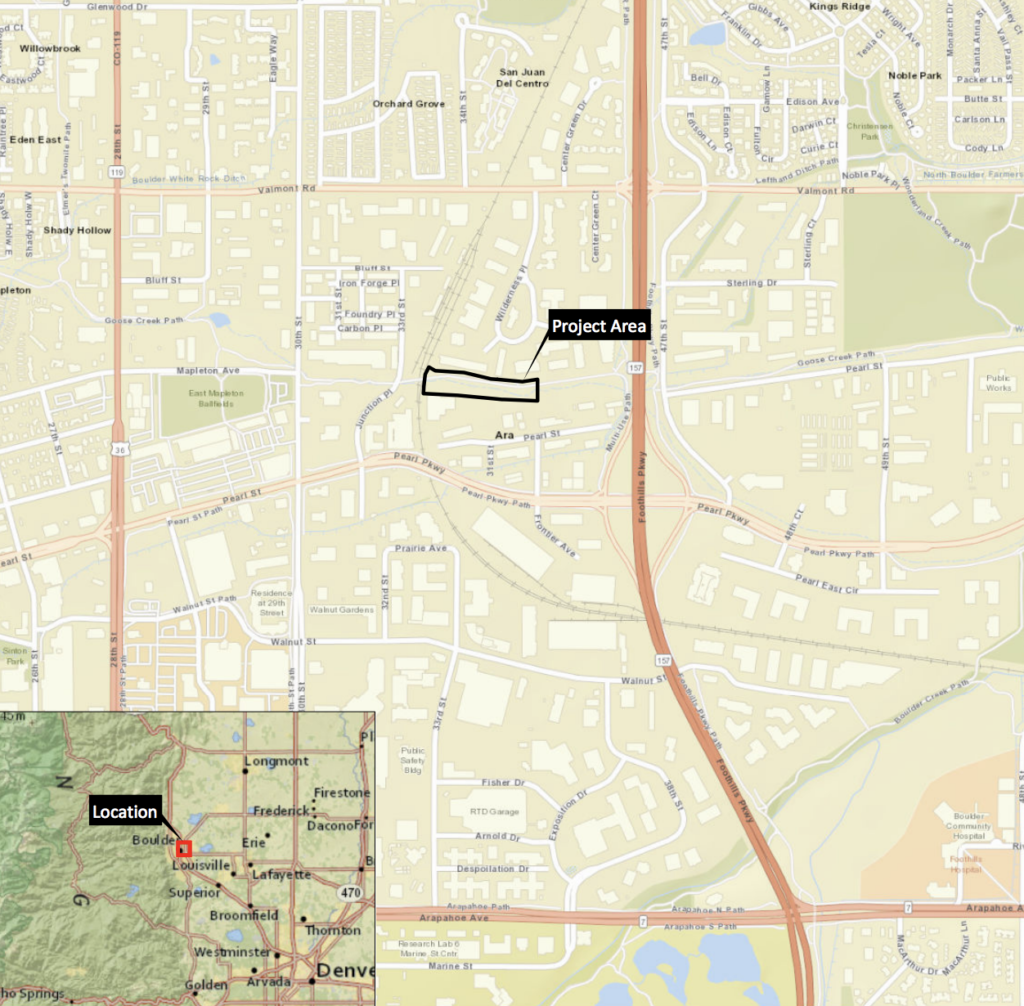
Project Location
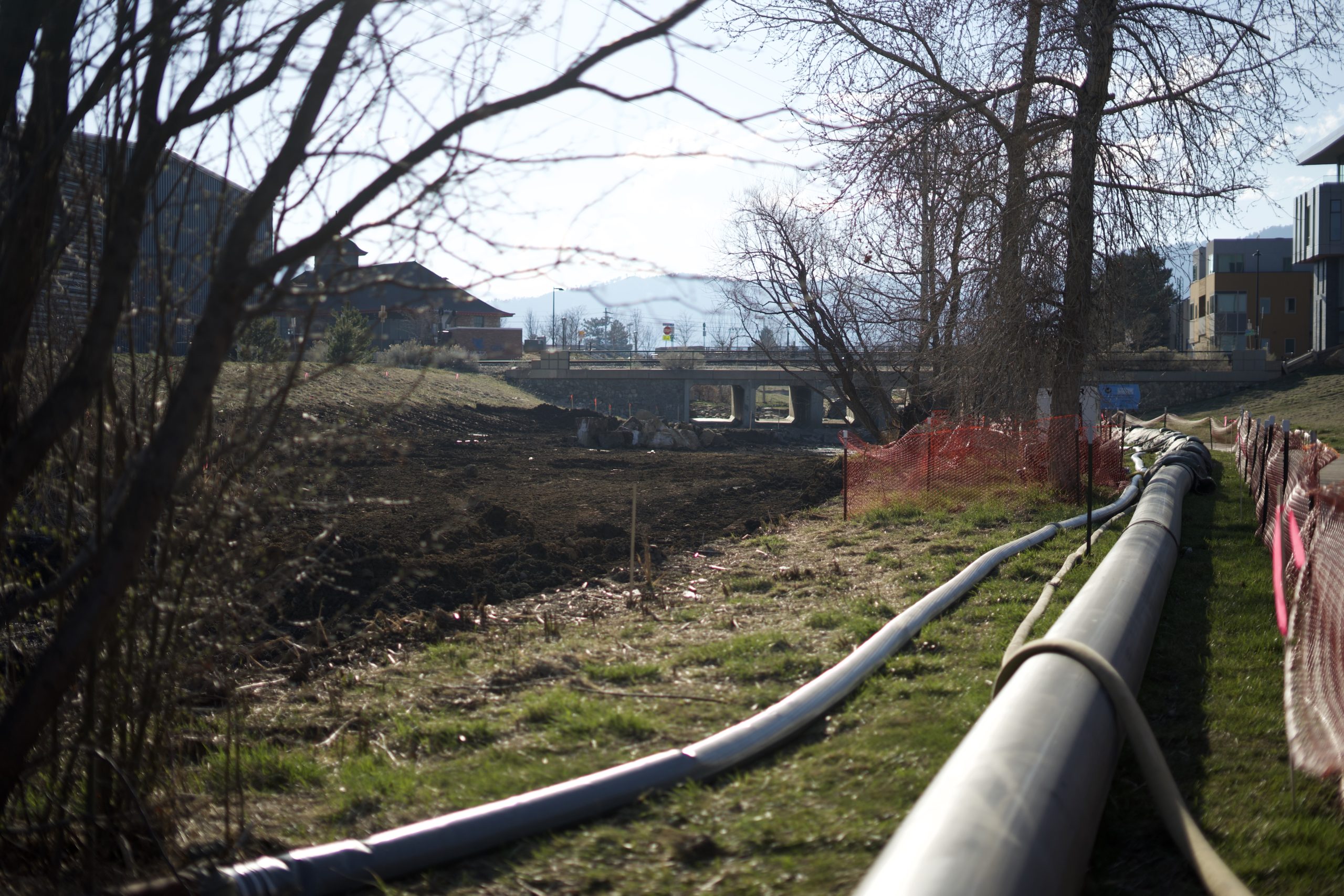
The project area is a narrow riparian strip along a 0.15 mile stretch of the Goose Creek that is about 650 feet upstream from Foothills Parkway. This location was chosen due to the extreme sediment accumulation that can lead to flooding. Sediments have been accumulating here leading to excessive cattail growth due to the creek slope.
Wetland vegetation in the area:
- Reed canary grass (Phalaris arundinacea)
- Arctic rush (Juncus arcticus)
- Sandbar willow (Salix exigua) – can potentially support Preble’s jumping mouse
- Plains cottonwood (Populus deltoides)
- Smooth brome (Bromus inermis)
- Snowberry (Symphoricarpos occidentalis)
- Skunk brush (Rhus trilobata)
Project Outline
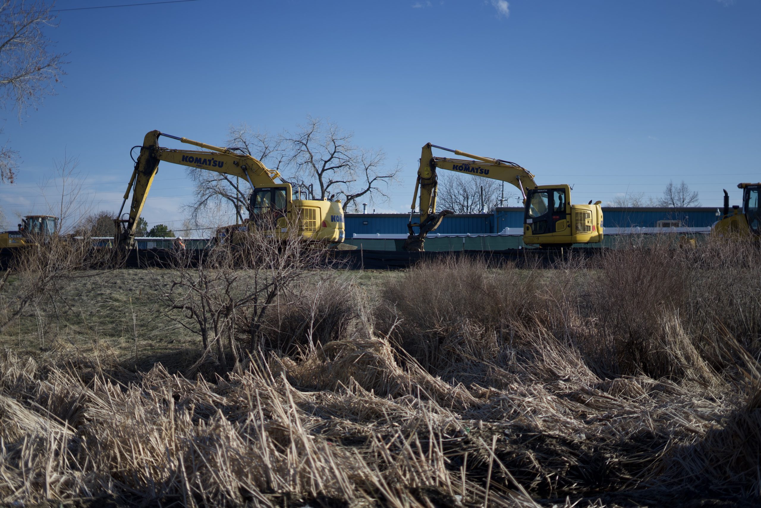
This project was proposed in May of 2019 and began at the end of January 2020. There are many proposed channel improvements for this project and of those, arguably the most important are the modifications to the channel itself: modifying the grade, realigning, and reshaping the channel to improve the water flow and reduce flood risk. Realignment of the channel will result in a 4-foot-wide low-flow channel with 3-foot-wide side slopes and a 6-foot-wide wetland bench (or buffer) parallel to the channel. This wetland bench provides a buffer should the main channel flood. Buffers are very important in wetland ecosystems: they slow down and absorb the runoff before it enters the stream (think pesticides, fertilizers, bacteria from dog poop, oil from roads), reduce and prevent erosion, and provide shade for the stream and thus reduce water temperatures. In this area they will be seeding and planting to provide natural wetland habitat. Additionally, they will be stabilizing the banks to ensure that water drains back into the creek and prevents extensive erosion. The storm sewer pipes have already been removed and they will be reset below ground. Finally, they will be making improvements to 21 feet of the path that runs alongside the creek. There is currently a low spot where water pools and exacerbates the flooding events. They will be cutting and removing that concrete and then regrading that area. Also in this area, a 4-foot-tall and 4-foot-wide concrete divider wall will be constructed to further protect the trail. They plan on this part of the project taking less than a week since it is so heavily used by pedestrians and bikers and the total project was estimated to finish near the second week of April 2020 (although this is subject to change). Plants to be used for revegetation (plugs, seed mix, hand plantings):
- Artic rush (Juncus arcticus)
- Clustered field sedge (Carex praegracilis)
- Elmory’s sedge (Carex emoryi)
- Nebraska sedge (Carex nebrascensis)
- Prairie cordgrass (Spartina pectinata)
- Woolly sedge (Carex pellita)
- Alkali sacaton (Sporobolus airoides)
- Canada wildrye (Elymus canadensis)
- Fowl bluegrass (Poa palustris)
- Fowl mannagrass (Glyceria striata)
- Hardstem bulrush (Schoenoplectus auctus)
- Showy milkweed (Asclepias speciosa)
- Swamp milkweed (Asclepias incarnata)
- Three-square bulrush (Schoenoplectus pungens)
- Blue grama (Bouteloua gracilis)
- Little blutestem (Schizachryium scoparium)
- Needle and thread grass (Hesperostipa comata)
- Sand dropseed (Sporobolus cryptandrus)
- Sideoats grama (Bouteloua curtipendula)
- Slender wheatgrass (Elymus trachycaulus)
- Western wheatgrass (Pascopyrum smithii)
- Plains cottonwood (Populus deltoides)
- Golden currant (Ribes aureum)
- Red-osier dogwood (Cornus sericea)
- Skunkbrush sumac (Rhus trilobata)
- Snowberry (Symphoricarpos occidentalis)
- Wild plum (Prunus americana)
- Sandbar willow (Salix exigua)
Effects on Wildlife
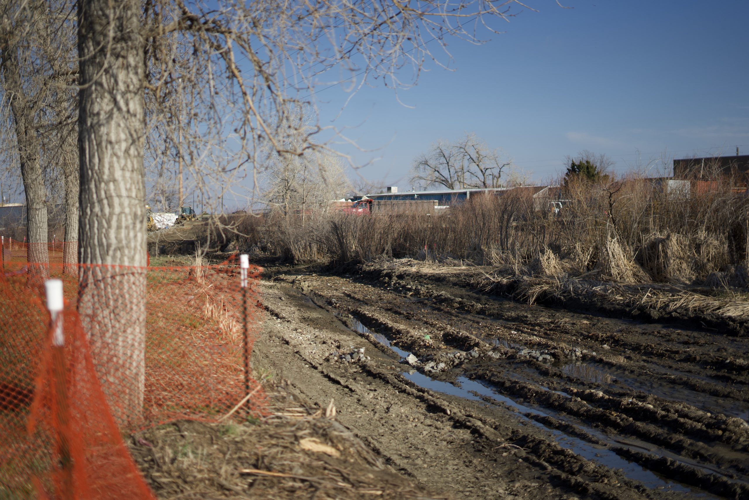
The proposal mentions extensive vegetation removal: 34 trees and 1500 sandbar willows. However, they ensure that all disturbed areas will be replanted with trees and shrubs. They also highlighted the fact that the wetlands that occur within the project area are not particularly unique or scarce. The species found within the project site are found all over the riparian communities of Boulder Valley and Colorado, so they will not be disturbing any organisms on the “threatened” or “endangered” species list. This part of Goose Creek was overrun with dense cattail wetlands. In fact, it’s believed that these restoration efforts will increase structural and species diversity since cattails won’t be taking over anymore, and they don’t anticipate any permanent adverse effects to the wetlands. Finally, The City of Boulder and the Mile-High Flood District will be monitoring this area for 5 years to ensure that the wetland mitigation is successful. They will go out during each growing season and counting trees, shrubs, and recording species cover in the seeded area.
Importance
Like it was stated earlier, wetland ecosystems are an important part of Boulder’s ecology. They provide much of the species diversity and offer a unique habitat for otherwise missing organisms in the area because of our climate. This project will do a great job at protecting this waterway in years to come by lessening the chance of flooding. Other restoration projects have been done in the area, including one on Fourmile Canyon Creek, downstream of 30th St, and it was very successful (meaning plant growth took off after the project and they have seen a decline in flooding events). It is likely more projects like this will be done in the future to keep protecting these wetlands. In fact, restoration is needed between 19th and Folsom for similar reasons. Some people might think, “Why do all this restoring? Just let nature do its thing”. However, the fact is, humans have been messing things up in this area for a long time, and so we have to do the work that we can to keep these ecosystems functioning as well as they can with thousands of people living close by. It’s exciting to see our community care so much about the nature surrounding us, and it will be great to see new plant and animal species take up root in this newly disturbed area on Goose Creek in place of the overrun cattails.
(All photos taken on 3/26/2020)

REFERENCES
- Boulder County Website
- Boulder Municipal Revised Code
- Boulder Valley Comprehensive Plan: 2015 Major Update, Adopted 2017
- City of Boulder Wetland Permit Application: Goose Creek at Foothills Parkway, May 2019
- Grasslands Ecosystem Management Plan, Adopted 2010